
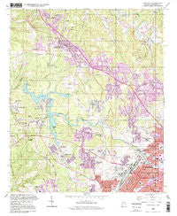
~ Adamsville AL topo map, 1:24000 scale, 7.5 X 7.5 Minute, Historical, 1993, updated 1998
Adamsville, Alabama, USGS topographic map dated 1993.
Includes geographic coordinates (latitude and longitude). This topographic map is suitable for hiking, camping, and exploring, or framing it as a wall map.
Printed on-demand using high resolution imagery, on heavy weight and acid free paper, or alternatively on a variety of synthetic materials.
Topos available on paper, Waterproof, Poly, or Tyvek. Usually shipping rolled, unless combined with other folded maps in one order.
- Product Number: USGS-5537495
- Free digital map download (high-resolution, GeoPDF): Adamsville, Alabama (file size: 17 MB)
- Map Size: please refer to the dimensions of the GeoPDF map above
- Weight (paper map): ca. 55 grams
- Map Type: POD USGS Topographic Map
- Map Series: HTMC
- Map Verison: Historical
- Cell ID: 168
- Scan ID: 303069
- Imprint Year: 1998
- Woodland Tint: Yes
- Aerial Photo Year: 1993
- Datum: NAD27
- Map Projection: Lambert Conformal Conic
- Map published by United States Geological Survey
- Map Language: English
- Scanner Resolution: 600 dpi
- Map Cell Name: Adamsville
- Grid size: 7.5 X 7.5 Minute
- Date on map: 1993
- Map Scale: 1:24000
- Geographical region: Alabama, United States
Neighboring Maps:
All neighboring USGS topo maps are available for sale online at a variety of scales.
Spatial coverage:
Topo map Adamsville, Alabama, covers the geographical area associated the following places:
- Minor - Forestdale - Little Italy - Sunset Mountain - Mulga Mine - Edgewater - Ensley - Maytown - Adamsville - Exum - Sherwood Hills - Village Creek Junction - Wylam - Daisey City Trailer Park - Hillcrest Estates - Frenchtown - Forestdale by the Brook - Sherman Heights - Falls Junction - Edgewater Junction - Docena - Glasgow - The Drifttracks - Scarlet Town - Daisey City - Crockard Junction - Graysville Heights - Oakwood - Republic - Shadyside - Graysville - Midway - Bay View - Ensley Highlands - Crumley Chapel - Tuxedo Heights - Grays Gardens - Merrywood - McDonald Chapel - Westwood Trailer Court - West Ensley - Forestdale Mobile Home Park - Westwood Garden Estates - Hobson - Sandusky - Westchester Estates - New Town - Hillview - Westwood - Dogtown - Longview Mobile Home Park - Union Grove - Longview Estates - Red Wine - Mulga - Forest View Estates
- Map Area ID: AREA33.62533.5-87-86.875
- Northwest corner Lat/Long code: USGSNW33.625-87
- Northeast corner Lat/Long code: USGSNE33.625-86.875
- Southwest corner Lat/Long code: USGSSW33.5-87
- Southeast corner Lat/Long code: USGSSE33.5-86.875
- Northern map edge Latitude: 33.625
- Southern map edge Latitude: 33.5
- Western map edge Longitude: -87
- Eastern map edge Longitude: -86.875


