

Ecuador and Galapagos Adventure Map 3403 by National Geographic Maps
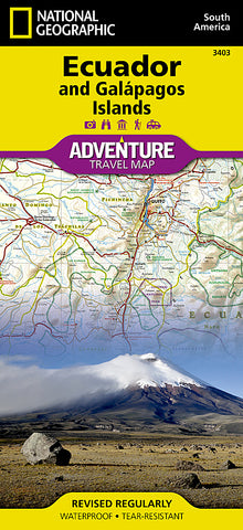
National Geographics Ecuador and Galapagos Islands AdventureMap is designed to meet the unique needs of adventure travelers with its durability and accurate information. This folded map provides global travelers with the perfect combination of detail and perspective, highlighting hundreds of points of interest and the diverse and unique destinations within the country.
The map includes the locations of cities and towns with a user-friendly index, plus a clearly marked road network complete with distances and designations for major highways, main roads, and tracks and trails for those seeking to explore more remote regions.
The front side of the map shows the southern half of Ecuador including the provinces of Zamora, Chinchipe, Loja, El Oro, Azuay, Cañar, Santa Elena, Guayas, Chimborazo, and Morona-Santiago. Galápagos is presented separately at larger scale, providing greater detail of the islands.
The provinces of Bolivar, Carchi, Cotopaxi, Esmeraldas, Imbabura, Los Rios, Manabí, Napo, Orellana, Tungurahua, Pastaza, Pichincha, Santo Domingo de los Tsáchilas, and Sucumbíos are included on the reverse side.
Every AdventureMap is printed on durable synthetic paper, making them waterproof, tear-resistant and tough - capable of withstanding the rigors of international travel.
- Product Number: 2050643M
- Product Code: NG_AM_ECU
- Publisher Product ID: AD00003403
- ISBN: 9781566955478
- Year of Publication: 2011
- Folded Size: 9.45 x 4.33 inches
- Unfolded Size: 24.8 x 34.45 inches
- Map type: Folded Map
- Geographical region: Ecuador