
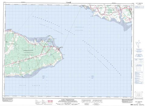
011L04 Cape Tormentine Canada topo map, 1:50,000 scale
011L04 Cape Tormentine NRCAN topographic map.
Includes UTM and GPS geographic coordinates (latitude and longitude). This 50k scale map is suitable for hiking, camping, and exploring, or you could frame it as a wall map.
Printed on-demand using high resolution, on heavy weight and acid free paper, or as an upgrade on a variety of synthetic materials.
Topos available on paper, Waterproof, Poly, or Tyvek. Usually shipping rolled, unless combined with other folded maps in one order.
- Product Number: NRCAN-011L04
- Parent Topo: TOPO-011L
- Map ID also known as: 011L04, 11L4, 11L04
- Unfolded Size: Approximately 26" high by 36" wide
- Weight (paper map): ca. 55 grams
- Map Type: POD NRCAN Topographic Map
- Map Scale: 1:50,000
- Geographical region: New Brunswick, Canada
Neighboring Maps:
All neighboring Canadian topo maps are available for sale online at 1:50,000 scale.
Purchase the smaller scale map covering this area: Topo-011L
Spatial coverage:
Topo map sheet 011L04 Cape Tormentine covers the following places:
- Amherst Cove - Augustin Cove - Augustine Cove - Baie Verte - Cape Traverse Cove - Cumberland Cove - Golfe du Saint-Laurent - Gulf of St. Lawrence - Guy Cove - Peacock Cove - Peacock Cove - Port Borden - Prevost Cove - Spence Cove - Traverse Cove - Victoria Harbour - Murray Beach - Rayworth Beach - Amherst Point - Bells Point - Birch Point - Borden Point - Cape Bruin - Cape Jourimain - Cape Jourimain - Cape Spear - Cape St. Laurent - Cape Tormentine - Cape Traverse - Gunning Point - Indian Point - Peacock Point - Peacock Point East - Prevost Point - Richard Point - Tryon Head - Wright Point - Abegweit Passage - Abegweit Passage - Détroit de Northumberland - Détroit de Northumberland - Northumberland Strait - Northumberland Strait - Botsford - Lot 28 - Lot 29 - Prince - Queens - Westmorland - Ephraim Island - Jourimain Island - Jourimain Islands - Prince Edward Island - Jones Pond - Websters Pond - Cape Jourimain National Wildlife Area - Murray Beach Provincial Park - Réserve nationale de faune du Cap-Jourimain - Île-du-Prince-Édouard - New Brunswick - Nouveau-Brunswick - Prince Edward Island - Barry Brook - Blacklock Brook - Brocklesby River - Cape Traverse River - East Branch Tryon River - Lanchester Creek - Lanchester Creek - Matt Brook - McKay Brook - Oulton Brook - Peacock Brook - Peacock Brook - Raworth Brook - Rayworth Brook - Robinson Creek - Robinson Creek - Scott Brook - Scott Brook - Trenholm Brook - Trout Brook - Trout Brook - Tryon River - Ward Brook - Westmoreland River - Westmorland River - Aggermore Rock - Heart Shoal - Jourimain Rock - Jourimain Rocks - Jourimain Shoal - Jourimain Shoals - Laurent Shoal - Rock Reef - Sand Reef - Spear Shoal - Tormentine Reef - Tormentine Reefs - Tryon Shoals - Augustin Cove - Augustine Cove - Bayfield - Borden - Cape Spear - Cape Tormentine - Cape Traverse - Cape Traverse Landing - Carleton Siding - Ferry Dock - Lane - Lower Tryon - Malden - Melrose - Murray Corner - Murray Road - Smith Settlement - Spence - Spence Settlement - Spencer - Tryon - Upper Cape - Cape Marsh - Borden-Carleton - Crapaud - Victoria


